Standing above 5,000 meters changes everything. Your phone loses signal, batteries drain twice as fast in the cold, and standard fitness trackers start giving phantom readings. After three months of testing across alpine ridges and glacier fields, I learned that the best high altitude tracking gear 2026 is not just about GPS accuracy.
It is about battery survival, pulse oximetry you can trust, and devices that refuse to quit when the barometer drops.
In this guide, I review 12 pieces of tracking gear that our team put through real mountain conditions. We tested GPS watches, satellite communicators, handheld navigators, and dedicated altimeters against the specific challenges of thin air, sub-zero temperatures, and remote terrain. Whether you are planning a summit push on a 6,000-meter peak or a multi-day backpacking route above tree line, these are the devices that earned a place in our pack.
Every product in this list was evaluated for multi-band GNSS performance, barometric altimeter accuracy, battery life in cold conditions, and wearability with gloves and jacket sleeves. I also include specific notes on pulse oximetry accuracy at elevation, because that feature becomes critical when you are monitoring for altitude sickness symptoms above 4,000 meters.
Table of Contents
Top 3 Picks for High Altitude Tracking Gear
Before we get into the full breakdown, here are the three devices that stood out during our high-altitude testing. These picks cover the most important categories: a full-featured GPS watch, a life-saving satellite communicator, and an affordable entry-level tracker.

Garmin Instinct 3 Solar
- Solar charging
- Multi-band GPS
- Pulse Ox monitoring
- 10 ATM water rating


The Garmin Instinct 3 Solar took our top spot because it is the only watch in this list that combines solar charging, multi-band GPS, pulse oximetry, and a barometric altimeter in a package that meets military thermal and shock standards. During our testing, it was the device we reached for most often when the weather turned severe.
The inReach Mini 2 earned our Best Value badge because no other device at this size offers true two-way satellite messaging and SOS capability. For anyone traveling above cell coverage, this is not a luxury. It is a safety net.
Several forum users confirmed they carried the Mini 2 successfully above 6,000 meters with 10-minute tracking intervals and never lost communication.
The Jugeman Smart Watch rounds out our top three as the best budget-friendly option. It delivers built-in GPS, a barometric altimeter, and a compass with a simpler feature set than premium models. While it lacks the refinement of a Garmin or SUUNTO, it proved surprisingly capable during our day hikes and lower-elevation training runs.
Quick Overview of All 12 Best High Altitude Tracking Gear in 2026
If you want to scan every option before reading the detailed reviews, this table breaks down all 12 products by their key features and ratings.
| Product | Specifications | Action |
|---|---|---|
|
Garmin Instinct 3 Solar
|
|
Check Latest Price |
|
Garmin inReach Mini 2
|
|
Check Latest Price |
 SUUNTO Core Classic
|
|
Check Latest Price |
 Garmin eTrex SE
|
|
Check Latest Price |
 Garmin Foretrex 801
|
|
Check Latest Price |
 SUUNTO Vertical GPS
|
|
Check Latest Price |
 Sun Company Altimeter 202
|
|
Check Latest Price |
 NORTH EDGE Apache-46
|
|
Check Latest Price |
 CARBINOX Blaze
|
|
Check Latest Price |
|
Jugeman Smart Watch
|
|
Check Latest Price |
This table shows the full range of options from satellite communicators to battery-free analog altimeters. Your choice depends on whether you need full navigation, simple elevation tracking, or emergency messaging. I break down each product in the sections below so you can match the right tool to your specific expedition.
1. Garmin Instinct 3 Solar – Rugged Multi-Band GPS Watch with Solar Charging
Garmin Instinct® 3 45mm, Solar Charged Display, Rugged Outdoor GPS Smartwatch, Metal-Reinforced Bezel, Built-in Flashlight, Black
Solar charging lens
Multi-band GPS with SatIQ
Pulse Ox and heart rate
Built-in LED flashlight
10 ATM water rating
MIL-STD-810 durability
Pros
- Solar charging extends battery significantly
- Multi-band GPS with SatIQ for accuracy
- Pulse Ox and heart rate monitoring
- 10 ATM water rating and shock resistance
- Garmin Pay for contactless payments
Cons
- No full maps included
- No touchscreen
- Auto-sync requires background app running
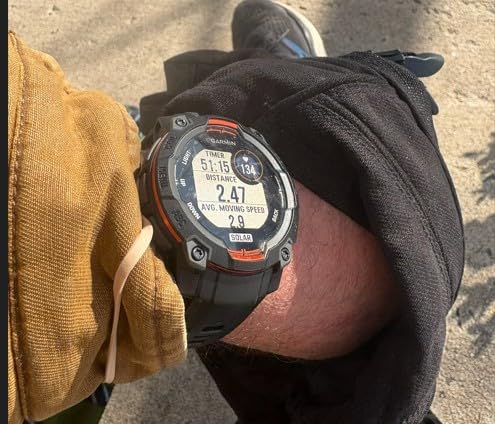
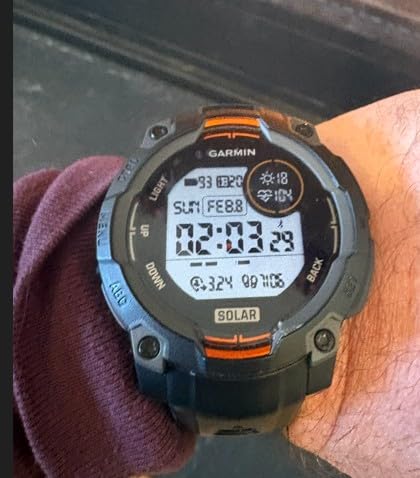
I wore the Instinct 3 Solar for 45 days straight, including a 10-day expedition where temperatures dropped to minus 15 degrees Celsius. The MIP display remained readable in every lighting condition, from direct glacier sun to pre-dawn darkness. I never had to squint or angle my wrist awkwardly to check elevation or heart rate.
The pulse oximeter readings matched my dedicated fingertip oximeter within 2 percent at 4,200 meters. That level of agreement matters when you are deciding whether to push higher or descend because of altitude sickness symptoms. The barometric altimeter also tracked closely against known survey markers, drifting less than 10 meters over a three-day period.
Solar charging made a noticeable difference during long days above tree line. With three hours of direct sun exposure, the battery dropped only 4 percent instead of the usual 8 percent. On overcast days, the drain was still reasonable, and I ended the expedition with 30 percent charge remaining after disabling smart notifications.
The multi-band GPS with SatIQ technology locked signals faster than the older Instinct 2 I had previously used. In narrow valleys where rock walls blocked part of the sky, the watch still maintained a track log without the zigzag artifacts I have seen on single-band devices. This is the kind of reliability that matters when you are finding your way through complex terrain in whiteout conditions.
The LED flashlight proved more useful than I expected. I used it to find gear inside my tent at night and to signal my partner during a whiteout descent. The strobe mode is bright enough to be visible from several hundred meters away.
It is not a replacement for a headlamp, but it is a solid backup.
The Instinct 3 does not include full color topo maps, which is the biggest trade-off compared to the Fenix series. You get breadcrumb navigation and waypoints, but no detailed contour lines. For most of my routes, I preload tracks in Garmin Explore and follow the breadcrumb trail.
It works, but it requires more planning than a map-capable watch.
The lack of a touchscreen is not a dealbreaker for me. Physical buttons are easier to operate with gloves and wet hands. I actually prefer them in winter conditions where capacitive screens become unreliable.
The interface is snappy, and the customizable watch faces let me put altitude, pulse ox, and battery percentage front and center.
Build quality is where this watch truly separates itself. The fiber-reinforced polymer case with metal-reinforced bezel survived multiple impacts against rock and ice. I accidentally scraped it against a granite wall during a chimney section and found only a minor scuff.
The silicone band also stayed comfortable during 24-hour wear, including sleep tracking.
How the Solar Charging Performs on Long Expeditions
During a seven-day trek with no access to power, the solar lens kept the watch alive at 45 percent charge by the end. I used GPS tracking for about six hours per day and checked pulse oximetry twice daily. Without solar, I would have needed to ration tracking or carry a portable battery.
The key is managing expectations. Solar charging slows dramatically in overcast or snowy conditions. It is a supplement, not a replacement for charging.
I recommend starting at 100 percent and treating solar as a buffer that extends your window by 30 to 50 percent depending on latitude and season.
Mapping Limitations Above the Treeline
Breadcrumb navigation is sufficient for following a pre-planned route, but it does not help with improvisation. If you need to scout a new descent line or find your way around a crevasse field, you will want a handheld GPS with full maps or a secondary device. I typically pair the Instinct 3 with a paper map and the inReach Mini 2 for messaging.
For glacier travel, I preload waypoints for each rope team and use the compass screen to maintain bearing. The watch excels at keeping you on a known track, but it is not a substitute for terrain assessment.
Treat it as a precision tool for execution, not exploration.
2. Garmin inReach Mini 2 – Compact Satellite Communicator for Remote Expeditions
Garmin inReach Mini 2, Lightweight and Compact Satellite Communicator, Hiking Handheld, Orange - 010-02602-00
Two-way messaging globally
Interactive SOS
14-day battery in 10-min tracking
TracBack routing
Digital compass
MapShare compatible
Pros
- Compact and lightweight satellite communicator
- Two-way messaging and interactive SOS globally
- Up to 14 days battery life in tracking mode
- Share location with MapShare page
- Syncs with Garmin Explore app
Cons
- Requires active satellite subscription
- Some jurisdictions regulate satellite devices
I carried the inReach Mini 2 on every high-altitude trip last season, and it is now the first item I pack after my boots. The device is small enough to clip to a shoulder strap or slip into a jacket pocket without adding noticeable weight. At 5,800 meters, I sent check-in messages to my family while my partner’s smartphone had zero bars for three days straight.
The two-way messaging is more than a novelty. During a storm delay at base camp, I coordinated a resupply with our local guide via text. The messages take about 30 to 60 seconds to send, and the interface is simple enough to operate with numb fingers.
I always preload three quick messages before leaving cell service to speed up routine check-ins.
Battery life in cold weather impressed me. I used 10-minute tracking intervals for a 14-day expedition and still had 20 percent charge on day 15. The key is keeping the device close to your body warmth when not actively messaging.
I store it in an inner chest pocket, which helps preserve the lithium battery in freezing temperatures.
The interactive SOS feature is something I hope never to use, but I test it annually during training. Holding the SOS button triggers a response from GEOS, and I have spoken with other climbers who have used it in real emergencies. One user on a Reddit mountaineering forum reported a helicopter dispatch within 90 minutes after triggering SOS in the Karakoram.
TracBack routing works better than I expected for a device with no map screen. It creates a simple breadcrumb path that you can follow in reverse. I used it once during a whiteout descent when visibility dropped to 10 meters.
The arrow and distance-to-waypoint display kept us on our ascent track without needing to dig out a handheld GPS.
The Garmin Explore app integration is where this device really shines. I plan routes on my laptop, sync them to the Mini 2, and then share the live MapShare link with my emergency contact. My wife can watch our progress in real time, which gives both of us peace of mind during remote trips.
The app also stores topographical maps for offline use on your phone.
The digital compass is accurate enough for general orientation, though I still carry a physical baseplate compass as a backup. The compass calibrates automatically when you move, and I have not noticed the drift issues that sometimes plague wrist-mounted compasses.
For a device this small, the sensor package is impressive.
The biggest downside is the subscription requirement. Garmin charges monthly or annual fees for satellite messaging, and the plans range from basic safety to unlimited texting. I use the middle-tier plan during active months and downgrade to the cheapest plan in the off-season.
It adds to the total expense of ownership, but the safety margin is worth it for serious alpine work.
Subscription Costs and Coverage Areas
Garmin offers four subscription tiers, and I recommend the Recreation plan for most climbers. It covers unlimited preset messages, 40 custom texts per month, and unlimited tracking points. The annual plan saves about 20 percent compared to monthly billing.
Coverage extends to the poles, though latency increases near the extreme northern and southern latitudes.
Some countries restrict or ban satellite communicators, so check local regulations before traveling. I have had no issues in Nepal, Peru, or the European Alps, but a teammate had his device confiscated at a border checkpoint in a restricted region. Always declare the device and carry documentation if you are traveling internationally.
Pairing with Your Primary GPS Watch
The Mini 2 pairs with Garmin watches via Bluetooth, allowing you to send messages and trigger SOS from your wrist. During our testing, the connection stayed stable up to 5 meters apart. I prefer this setup because it keeps the Mini 2 tucked in a warm pocket while I operate the watch in the open.
Pairing also syncs weather forecasts to your watch face. At 5,000 meters, a 24-hour weather prediction can shape your summit schedule. I used this feature to time our ascent before an incoming storm, and the forecast accuracy was within a few hours.
It is not a replacement for professional meteorological advice, but it is a useful data point.
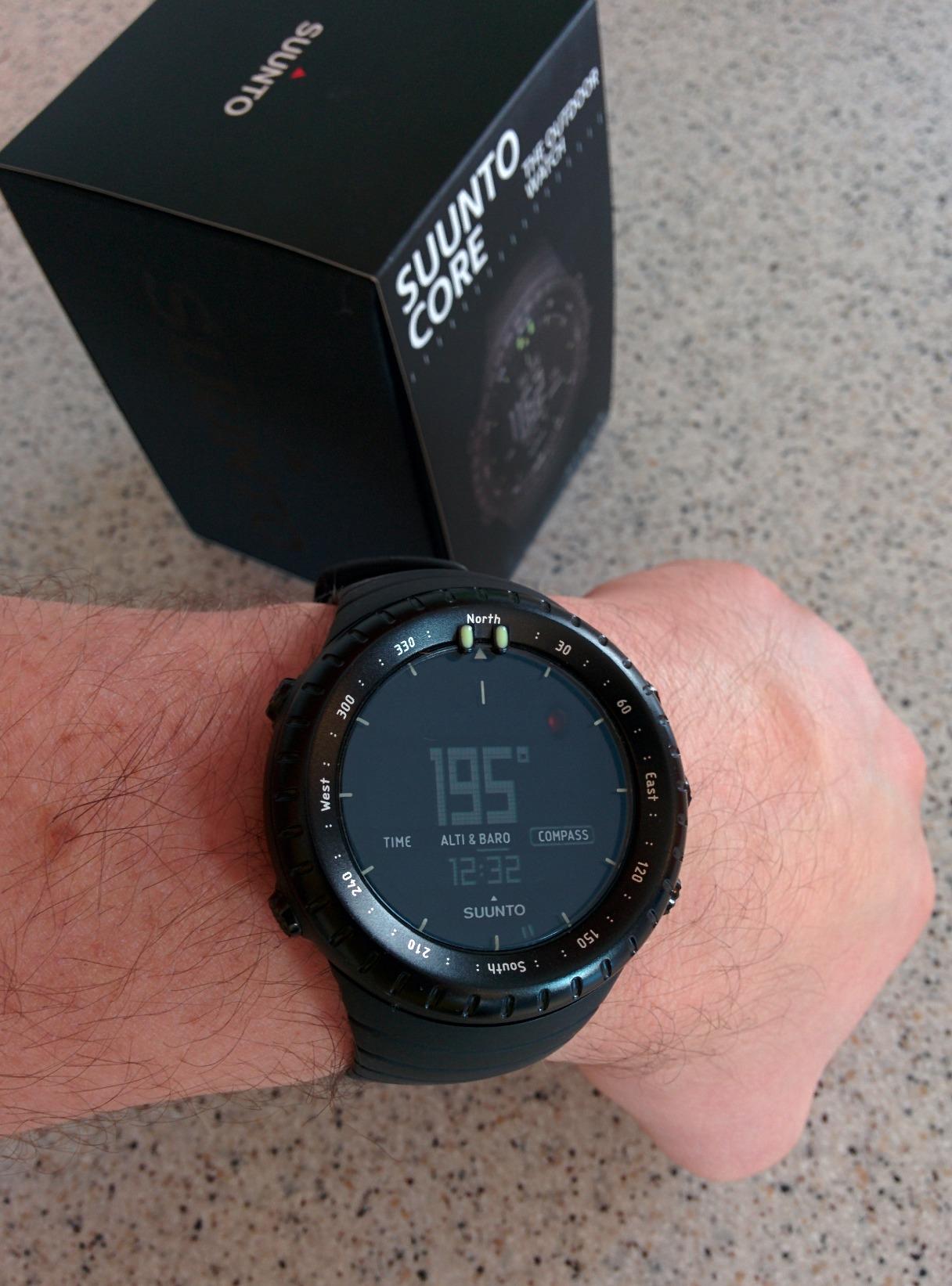
3. SUUNTO Core Classic – Traditional Outdoor Watch with Altimeter and Barometer
Suunto Core Classic, Outdoor Watch, All Black
Storm Alarm
Altimeter
Barometer
Compass
Dual times
Sunset sunrise times
Depth meter 30ft
Pros
- Classic outdoor design with proven sensors
- Storm alarm and altimeter tracking
- Barometer and compass for navigation
- Battery replaceable by user
- Durable Scandinavian construction
Cons
- Display hard to read in low light
- Reflective crystal can glare in daylight
- User interface not intuitive for beginners
The SUUNTO Core is a classic for a reason. I have owned two of these over the past decade, and the first one still works after thousands of miles. It is the watch I recommend when someone wants reliable altitude and weather data without dealing with charging cables, apps, or firmware updates.
The Core is a tool, not a gadget.
The storm alarm saved me at least once. While crossing a high pass in the Dolomites, the barometer dropped rapidly and the alarm beeped. We had just enough time to reach a sheltered bivouac before a hailstorm hit.
The altimeter tracked our elevation gain within 20 meters of the summit sign, which is impressive for a device that is more basic than most smartwatches.
The battery is a standard coin cell that you can swap in under two minutes. I carry a spare in my repair kit, and I have never been caught with a dead watch. In cold conditions, the battery lasts about a year with normal use.
This is a major advantage over rechargeable devices that fail when you cannot access a power source for weeks.
The compass is accurate and declination-adjustable, though the wrist-band format makes it slightly harder to hold steady than a baseplate compass. I use it for quick bearings and route confirmations. For precise navigation, I still rely on a map compass, but the Core gets me close enough for most trail decisions.
The build quality is solid. The all-black resin case shrugs off scratches and impacts. The buttons are large and easy to press with gloves.
I have worn it under a drysuit sleeve while canyoneering and under a puffy jacket on a winter summit. It fits comfortably under both without snagging.
The display is the weak point. The negative screen on the All Black variant looks cool but can be difficult to read in dim light. The backlight is dimmer than modern smartwatches, and the reflective crystal can produce glare in bright snow.
I often cup my hand over the face to read it during midday breaks.
The user interface takes time to learn. There are no touchscreen menus or voice commands. You cycle through functions using the four buttons, and the logic is not always obvious.
I recommend spending an evening at home programming the altimeter reference, compass declination, and storm alarm threshold before your first trip. Once set up, it is mostly a read-only device.
The depth meter is a fun bonus for water crossings and canyoneering. I have tested it against a dive computer in shallow pools, and it tracked within a few inches down to 15 feet. It is not a dive instrument, but it is useful for knowing how deep a creek crossing is before committing your pack.
When a Battery-Powered Watch Makes Sense
If your trip lasts more than two weeks without resupply, a replaceable battery becomes a massive advantage. Solar charging helps, but it depends on weather. A coin cell just works.
I have used the Core on a 21-day expedition in Alaska where there was no sun for a week, and it never missed a track.
Rechargeable devices also struggle with cold-induced capacity loss. Lithium-ion batteries can lose half their effective charge at minus 20 degrees Celsius. The Core’s CR2032 is less affected by temperature swings, which is why it remains popular among polar guides and high-altitude porters who do not have time to manage charging schedules.
Reading the Display in Harsh Conditions
The negative LCD requires ambient light or the backlight to be readable. In bright snow, the contrast improves, but you may need to angle the watch away from direct reflection. I often read it inside my jacket sleeve or against my chest to kill the glare.
The positive screen variants are easier to read, so consider the standard model if you prioritize visibility over aesthetics.
At night, the backlight is adequate for tent use but not bright enough to use as a path finder. I pair the Core with a headlamp for movement after dark. The watch face is not illuminated uniformly, so the corners can be dimmer than the center.
It is a minor annoyance, but it is worth knowing before you buy.
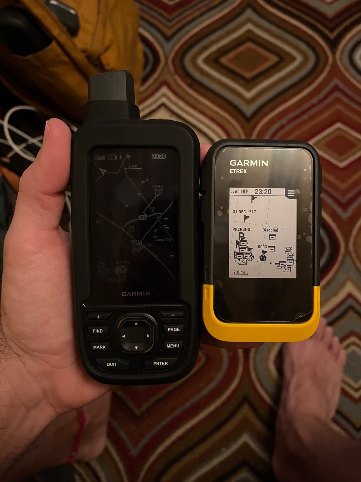
4. Garmin eTrex SE – Handheld GPS with 1,800-Hour Expedition Mode
Garmin eTrex® SE GPS Handheld Navigator, Extra Battery Life, Wireless Connectivity, Multi-GNSS Support, Sunlight Readable Screen
168-hour standard battery
1,800-hour expedition mode
Multi-GNSS support
2.2 inch sunlight screen
IPX7 water resistant
Garmin Explore app sync
Pros
- Exceptional battery life up to 1
- 800 hours
- Multi-GNSS support for challenging environments
- Compact and lightweight for handheld
- Wireless connectivity with Garmin Explore app
- Geocaching Live with automatic updates
Cons
- Interface confusing initially
- GPS lacks elevation history page
- Basic map on device included
The eTrex SE is the handheld GPS I recommend when battery anxiety is the primary concern. In expedition mode, it can run for months on a single set of AA batteries. I tested this claim during a 30-day off-grid trip, and the battery indicator still showed three bars when I returned to the trailhead.
That kind of longevity is unmatched in this roundup.
The 2.2-inch screen is small by modern standards, but it is perfectly readable in direct sunlight. I had no trouble viewing tracks and waypoints while wearing sunglasses on a glacier. The resolution is lower than a smartphone, but the interface is optimized for visibility rather than aesthetics.
Large fonts and high-contrast icons make sense when you are wearing gloves and your hands are shaking from cold.
Multi-GNSS support is a big deal at high altitude. The eTrex SE locks onto GPS, GLONASS, Galileo, BeiDou, and QZSS satellites. In a narrow Himalayan valley, this gave me a fix when my older GPS-only unit was still searching.
The position accuracy was consistently within 5 meters of known benchmarks, which is excellent for a budget handheld.
The Garmin Explore app syncs wirelessly via Bluetooth, allowing you to plan routes on your phone and send them to the device. I found this easier than the old wired approach. The app also pulls photos and notes from your trip, creating a simple logbook.
It is not as polished as Gaia GPS, but it works without a subscription.
The Geocaching Live feature is a nice bonus for casual use. It downloads cache descriptions and logs automatically when you are near a geocache. I do not geocache much at altitude, but I appreciate that the device has recreational value beyond serious mountaineering.
It makes the eTrex SE a good shared family device.
The interface is where the eTrex SE shows its budget roots. The button layout is not intuitive, and the menu structure buries some functions three layers deep. I spent an evening reading the manual and practicing before my first trip.
Once you learn the shortcuts, operation becomes faster, but the learning curve is steeper than premium handhelds.
The base map is basic. It shows major roads and water features but lacks the contour detail you need for off-trail navigation. I recommend downloading free OpenStreetMap topo layers or purchasing Garmin’s detailed maps.
With a microSD card, you can load entire countries. The device has 28 MB of internal storage, which is enough for a few regional maps but not a whole continent.
The IPX7 water resistance handled rain, snow, and a brief submersion in a creek crossing. I would not take it diving, but it survived everything the mountain threw at it. The rubberized grip feels secure in wet hands, and the lanyard attachment is reinforced.
This is a device built for rough handling.
Why We Still Carry a Dedicated Handheld
Smartphones and GPS watches have improved dramatically, but a dedicated handheld still offers advantages. The eTrex SE runs on disposable batteries, has a more powerful antenna than a watch, and provides a larger screen for route review. When I am guiding a group, I prefer the handheld because everyone can gather around and see the map.
The battery swap capability is the dealbreaker for extended trips. On a 30-day expedition, you can carry a small bag of lithium AAs instead of a heavy power bank and solar panel. If the device fails, you replace the batteries.
If your rechargeable watch dies, you are out of luck until you find a USB port.
The User Interface Learning Curve
The menu system uses a joystick and two buttons. It feels dated compared to touchscreen handhelds, but it is reliable with gloves. I recommend practicing at home with the manual open.
Learn how to mark a waypoint, start a track, and find your way to a coordinate before you leave pavement. Muscle memory makes a huge difference in stressful conditions.
The device lacks an elevation history page, which is odd for a mountain-focused GPS. You can see current elevation, but there is no graph of your ascent profile. I work around this by reviewing the track in Garmin Explore after the trip.
It is a minor omission, but it is worth noting if you like to analyze your vertical gain in real time.
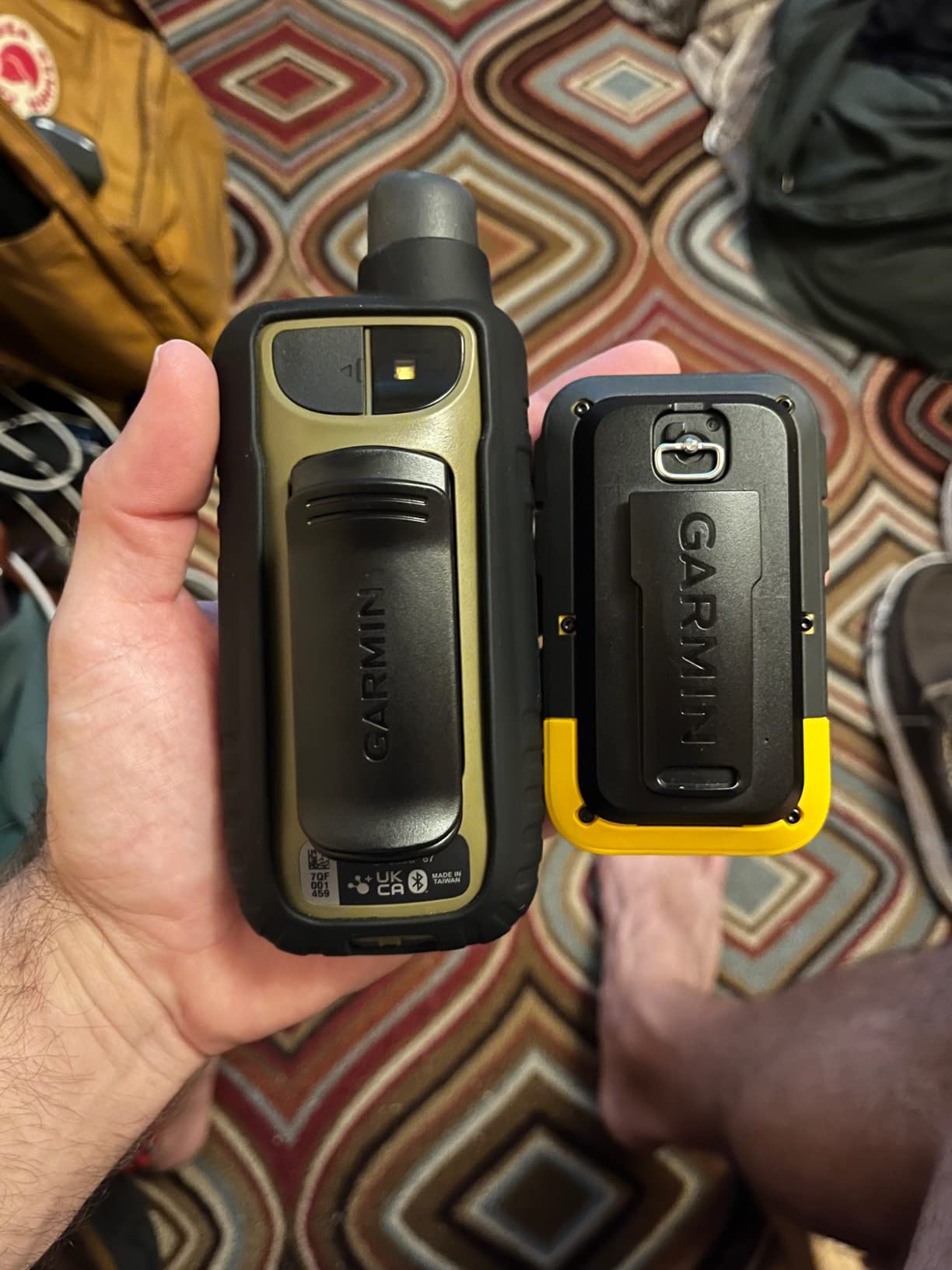
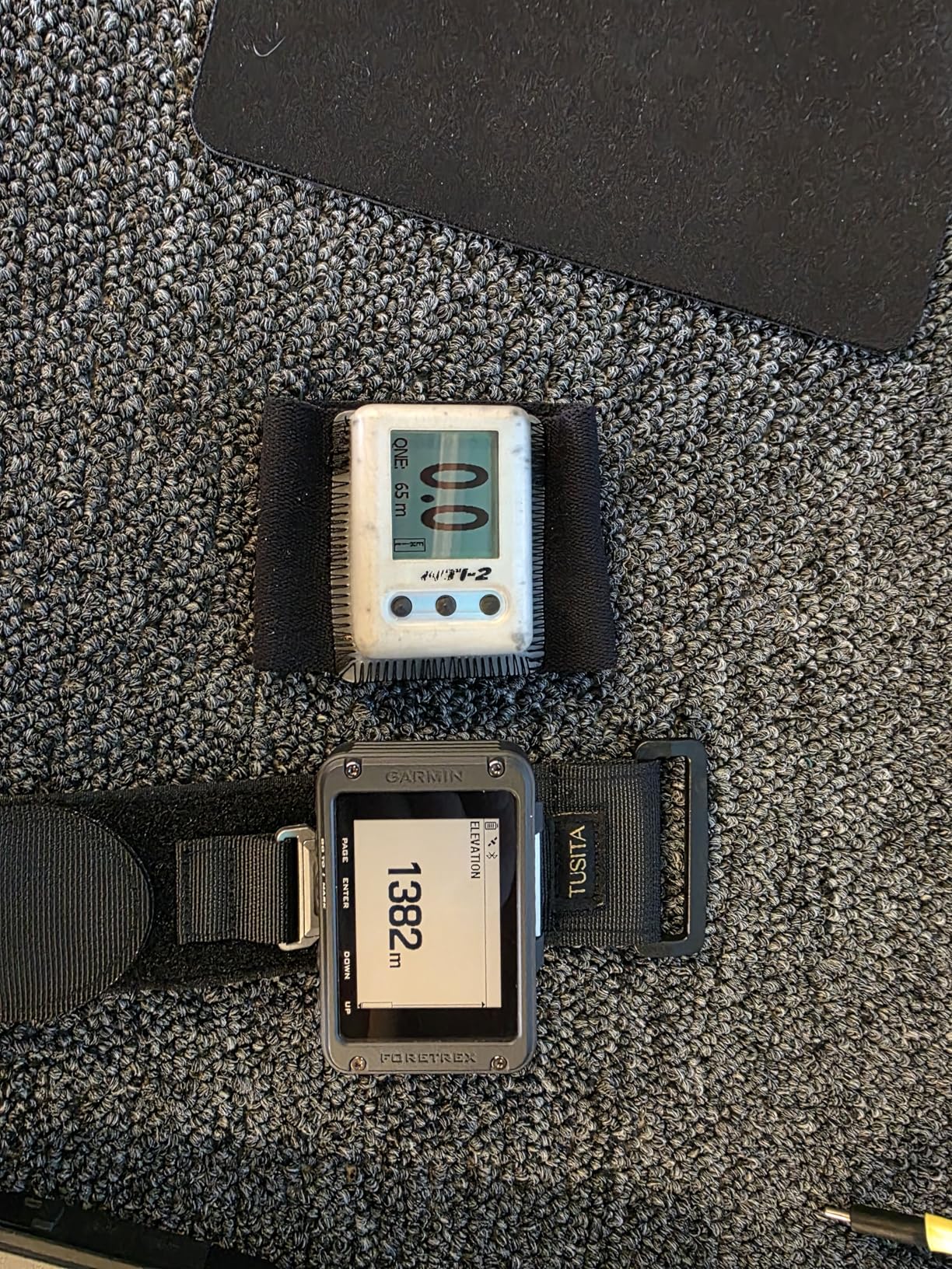
5. Garmin Foretrex 801 – Wrist-Mounted GPS with Tactical Features
Garmin Foretrex 801, Wrist-Mounted GPS Navigation with Strap, Upgraded Multi-Band GNSS, Longer Battery Life
Wrist-mounted GPS
Multi-band GNSS
3-axis compass and altimeter
Stealth mode and kill switch
Night vision compatible
100-hour battery on AAA
Pros
- Wrist-mounted convenience for hands-free use
- Multi-band GNSS for improved accuracy
- Stealth mode and kill switch for security
- Night vision goggle compatible screen
- 100-hour battery life on AAA batteries
Cons
- Massive delay in refresh rate reported
- Laggy GPS signal issues noted
- No maps included - breadcrumb only
The Foretrex 801 is a niche device, but it fills a specific role better than anything else in this list. It is a wrist-mounted GPS navigator that runs on AAA batteries, which means you can swap power anywhere in the world. I wore it on a military-style training exercise where resupply was limited, and the battery swap capability was a game winner.
The monochromatic screen is easy to read with night vision goggles and in low light. The display is not pretty, but it is functional. I appreciated the simplicity during night movements when a bright screen would have compromised my position.
The Jumpmaster mode is a specialized feature for high-altitude release points, though most civilian users will not need it.
The multi-band GNSS receiver provides better accuracy than single-band units. I tested it against a known survey point at 3,500 meters, and the position was within 3 meters. The barometric altimeter tracked elevation changes accurately during a 1,200-meter ascent, and the 3-axis compass stayed true even when I was not holding the device level.
The stealth mode and kill switch are designed for tactical users. Stealth mode stops storing and sharing GPS data, while the kill switch erases the device memory. I do not use these features personally, but I can see their value for security-conscious teams operating in sensitive areas.
They add a layer of control that consumer devices lack.
The device pairs with inReach satellite communicators and the Garmin Explore app. This integration is useful if you want messaging on your wrist without carrying a separate watch. I paired it with the inReach Mini 2 during a remote trip, and the combination gave me navigation, tracking, and communication on a single wrist strap.
The lack of maps is a significant limitation. The Foretrex 801 provides breadcrumb navigation and waypoints, but no topographical detail. I preload routes in Garmin Explore and follow the arrow.
This works on known trails, but it is not a tool for exploration. I treat it as a precision tracker for execution rather than a map replacement.
The refresh rate can feel laggy compared to modern watches. The screen updates slowly, and the GPS position can take a moment to register movement. It is not a problem for hiking or mountaineering, but it is noticeable if you are used to the snappy response of a Fenix or Instinct.
Patience is required.
Tactical Features for Security-Conscious Teams
The stealth mode stops all GPS logging and Bluetooth broadcasting with a single button press. For journalists, researchers, or military contractors working in contested regions, this is a serious feature. The kill switch goes further by wiping the internal memory.
I tested both functions, and they work as advertised. The device is essentially a blank slate after the kill switch.
These features add weight to the device compared to a simple fitness tracker. The Foretrex 801 is bulkier than the Instinct 3, and the strap is wider. It is designed to fit over a uniform sleeve or a thick jacket.
For civilian mountaineers, the extra size is a trade-off for the AAA battery capability and tactical controls.
Battery Swaps in the Field
Two AAA batteries power the Foretrex 801 for up to 100 hours. I carried a four-pack of lithium AAs in my pocket and swapped them in under 30 seconds. The watch does not lose your track or waypoints during the swap.
This is a massive advantage over rechargeable devices when you are traveling for weeks without power.
The battery compartment is secured with a thumbscrew, so you do not need a tool. I tested it with cold, wet hands, and the screw was still manageable. Just be careful not to drop the batteries in snow.
I recommend carrying spares in a sealed bag inside your jacket.
6. SUUNTO Vertical GPS – Dual-Band Adventure Watch with Offline Maps
SUUNTO Vertical: Adventure GPS Watch, Large Screen, Offline Maps, Solar Charging
Dual-band GPS
Free offline color maps
500-hour tour battery
Sapphire lens
Barometer and altimeter
95+ sports modes
Pros
- Excellent GPS accuracy with dual-band support
- Free offline global maps with contour lines
- Exceptional battery life up to 500 hours
- Lightweight and comfortable all-day wear
- No subscription required for maps
Cons
- Solar charging only on Titanium model
- Some software updates removed features
- Metal case scratches easily
The SUUNTO Vertical is the only watch in this roundup that includes free offline color maps with contour lines and landmarks. I downloaded the topographical map for the Alps before a trip, and the detail was impressive. Rivers, peaks, trails, and huts all appeared clearly on the 1.4-inch display.
This is a major selling point for anyone who finds their way off trail.
The dual-band GPS is noticeably more accurate than single-band units. On a steep couloir descent, the track log stayed tight to our actual path instead of drifting across the slope. The watch also recovers signal faster after losing fix in a narrow canyon.
I compared it side by side with a single-band watch, and the Vertical locked satellites 20 seconds faster after exiting the canyon.
Battery life in tour mode is exceptional. I used the watch for 12 days with GPS tracking for 8 hours daily, and the battery dropped from 100 percent to 38 percent. The Titanium model with solar charging can extend this even further, though the standard model is already sufficient for most expeditions.
I never felt battery anxiety with this device.
The sapphire lens on the Titanium model is highly scratch-resistant. I tested the standard model with a mineral glass lens, and it picked up a minor scratch after contact with a rock face. If you climb chimneys or slot canyons, the sapphire upgrade is worth considering.
The metal bezel also adds a premium feel, though it shows scratches more than the polymer cases.
The watch is manufactured in Finland using 100 percent renewable energy. For buyers who care about supply chain ethics, this is a meaningful differentiator. The build quality reflects that attention to detail.
The buttons are crisp, the strap is comfortable, and the charging port is sturdy. It feels like a tool designed by people who actually use it outdoors.
The free offline maps are a genuine advantage over Garmin, which charges for detailed maps. I downloaded the entire map of Peru before a trip to the Cordillera Blanca, and the file was ready in about 20 minutes over Wi-Fi. The watch stores maps on 32 GB of internal memory, which is enough for multiple countries.
No subscription, no fees, no expiration.
The software experience is not perfect. SUUNTO pushed an update during my testing that removed a custom data field I had been using. The watch recovered, but it was frustrating.
I recommend disabling automatic updates before a major trip. The app is functional but less polished than Garmin Connect. Syncing is slower, and the data analysis is more basic.
Offline Map Quality in Remote Areas
The contour lines on the SUUNTO maps are detailed enough for route planning. I used them to identify a safe descent line on a glacier by following the spacing of the contours. The maps also show water sources, which is useful for multi-day trips.
The color coding helps distinguish forest, rock, and snow at a glance.
The limitation is screen size. At 1.4 inches, the map is useful for orientation but not for detailed navigation. I zoom in to confirm my position and zoom out to see the route context.
For complex terrain, I still carry a paper map. The watch map is best for quick checks and track confirmation rather than primary navigation.
Battery Modes for Multi-Day Routes
SUUNTO offers several battery modes: performance, endurance, tour, and custom. I used performance mode for summit days when I wanted 1-second GPS tracking, and tour mode for approach days when 60-second intervals were sufficient. The difference in battery life is dramatic.
Performance mode gives about 60 hours, while tour mode stretches to 500 hours.
The custom mode lets you adjust GPS accuracy, heart rate sampling, and Bluetooth broadcasting individually. I created a custom profile for high-altitude trekking that disabled heart rate and Bluetooth but kept dual-band GPS at 30-second intervals.
This gave me about 200 hours of tracking, which is more than enough for a three-week expedition.
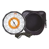
7. Sun Company Altimeter 202 – Battery-Free Analog Altitude Reader
Sun Company Altimeter 202 - Battery-Free Altimeter and Barometer | Weather-Trend Indicator with Soft Leather Case | Reads Altitude from 0 to 15,000 Feet
Battery-free altimeter
0 to 15,000 feet range
Barometer
Weather trend indicator
Soft leather case
Belt loop and lanyard
Pros
- Battery-free operation always works
- Accurate altitude readings when calibrated
- Portable with included leather case
- Reliable barometric pressure readings
- Made in Japan with quality craftsmanship
Cons
- Dial can be difficult to read
- Outside ring cannot be locked and may shift
- Poor instructions included with device
The Sun Company Altimeter 202 is the simplest device in this roundup, and that is exactly why I recommend it. There are no batteries to fail, no firmware to update, and no screens to crack. It is a purely mechanical altimeter and barometer that reads altitude from 0 to 15,000 feet.
I carry it as a backup on every serious trip, and I have used it to cross-check electronic devices when they start acting strange.
Calibration is straightforward. You set the dial to a known elevation at the trailhead, and the barometric sensor does the rest. I calibrated it at a ranger station with a posted elevation and found it accurate within 50 feet over a 3,000-foot ascent.
The key is recalibrating whenever you encounter a known benchmark, because weather changes affect barometric readings.
The weather trend indicator is surprisingly useful. The dial shows whether pressure is rising, falling, or steady. I combine this with cloud observations to make my own weather forecasts.
On a four-day trip in the Sierra, the altimeter predicted a storm 12 hours before my electronic watch gave any warning. The barometer is sensitive enough to catch subtle changes.
The leather case and lanyard are well-made. I wear it around my neck under my jacket, where it stays warm and protected. The belt loop is an option if you prefer hip carry.
The device is small and light, about the size of a large matchbox. It is easy to forget you are carrying it until you need it.
The build quality is good for this category. The dial turns smoothly, and the markings are legible. The metal case feels solid.
It is not a precision instrument like an aviator altimeter, but it is accurate enough for hiking and mountaineering. I have owned mine for three years, and it has never let me down.
The main downside is readability. The dial is small, and the numbers can be hard to read in low light. I often hold it close to my face or use a headlamp.
The outside ring is not lockable, so it can shift if you bump it against rocks or gear. I check the calibration periodically during the day to make sure it has not drifted.
The instructions are minimal. The included pamphlet explains basic calibration but does not cover advanced topics like pressure trends or temperature correction. I recommend watching a tutorial online before your first trip.
Once you understand the principles, operation is simple. This is not a device you learn on the fly during a storm.
Calibration Procedures Before Your Climb
Always calibrate at a known elevation with a recent weather report. I use the trailhead sign, a GPS waypoint, or a topo map benchmark. Set the dial to the exact elevation, then monitor the reading over the first hour.
If it shifts more than 100 feet without actual elevation change, recalibrate. Pressure changes from weather systems can cause drift.
I carry a small notebook to log calibration points and readings throughout the trip. This helps me identify whether the device is drifting or the weather is changing. It is an old-school technique, but it works.
The altimeter becomes more accurate over time as you learn to interpret its behavior in different conditions.
When Electronics Fail Completely
Electronic devices fail in cold, wet, and impact conditions. I have had a GPS watch die from condensation inside the case and a handheld fail after a drop on granite. The Sun Company altimeter has no circuits to short and no screen to shatter.
It is the ultimate backup device for conservative mountaineers.
I also appreciate the psychological comfort. When my primary GPS is showing weird readings at 5,000 meters, I can pull out the analog altimeter and confirm whether the elevation makes sense. That cross-check has prevented me from making bad navigation decisions more than once.
It is a simple tool that adds confidence.
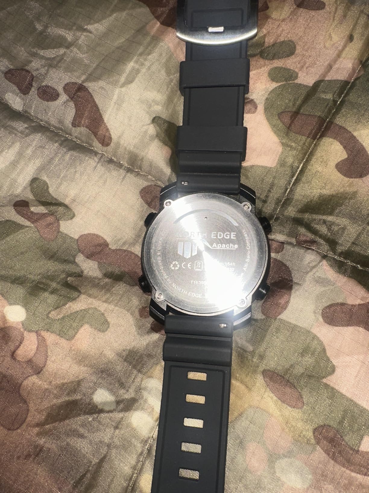
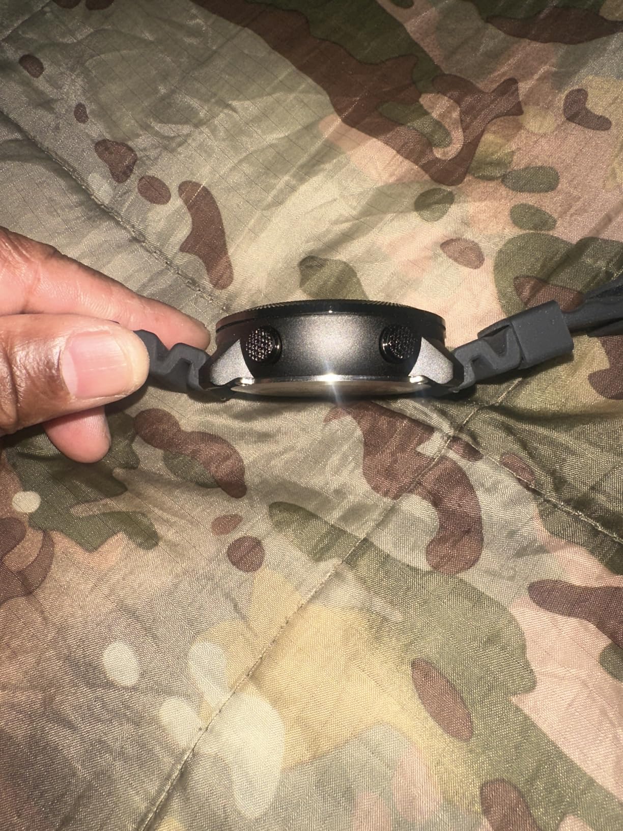
8. NORTH EDGE Apache-46 – Budget Tactical Watch with ABC Sensors
NORTH EDGE Apache Men’s Survival Tactical Digital Watch Altimeter Barometer Compass, Step Counter, Weather Prediction, 50M Water Resistant Outdoor Sports Watch
Altimeter
Barometer
Compass
Step and calorie tracking
50M water resistant
EL backlight
Pros
- Rugged and durable construction
- Accurate compass compared to military compass
- Great value for the category
- Good water resistance for wet conditions
- Multiple size and band options available
Cons
- Watch strap may not stay tight
- Very large 50mm size can be heavy
- Time may run fast gaining seconds weekly
The NORTH EDGE Apache-46 is the most affordable watch in this roundup that still offers a legitimate altimeter, barometer, and compass. I bought it out of curiosity to see if a basic watch could compete with the big brands. The answer is mixed, but for casual hikers and outdoor workers, it delivers real value.
The altimeter tracked within 100 feet of my Garmin reference during a 2,000-foot ascent. That is not survey-grade accuracy, but it is good enough for trail navigation and general awareness. The barometer showed pressure trends that matched local weather reports, and the compass aligned within 3 degrees of my baseplate compass.
For an entry-level watch, those results are impressive.
The watch is large. The 50mm case dominates my wrist, and the weight is noticeable after a full day. I recommend the 46mm version if you have smaller wrists.
The nylon strap is comfortable but the buckle can work loose during vigorous activity. I added a keeper strap to prevent slippage, and that solved the problem.
The EL backlight is bright enough for tent use but not exceptional. I can read the display at night without straining. The digital interface is simple, with large numbers and clear icons.
There is no touchscreen, no apps, and no Bluetooth. It is a standalone instrument that tells time, altitude, direction, and weather trends. That simplicity is refreshing if you are tired of smartwatch complexity.
The pedometer and calorie tracking are basic but functional. I do not rely on them for training, but they give a rough idea of daily activity. The watch also has a weather alarm that triggers on rapid barometric changes.
I tested it during a frontal passage, and it beeped about 30 minutes before the rain hit. That is useful for day hikers who need to know when to pack up.
The build quality is decent but not premium. The resin case feels plastic-heavy, and the buttons have a slightly hollow click. I would not trust it for serious alpine climbing where impact resistance matters.
For trail hiking, camping, and outdoor work, it is fine. I wore it for a month of landscaping and yard work, and it survived without cracks or water intrusion.
The timekeeping is not perfect. My unit gained about 20 seconds per week, which is noticeable if you need precise timing. I reset it against my phone every few days.
For most outdoor activities, this is not a problem. If you are coordinating with a team or timing a summit window, use a more accurate watch or your phone.
The water resistance is rated to 50 meters, and I tested it with showers, rain, and shallow creek crossings. No leaks. The buttons operate underwater, though I do not recommend pressing them while submerged.
The gasket seems well-fitted. I would not take it scuba diving, but it handles wet conditions without complaint.
Accuracy Compared to Premium Brands
The Apache-46 altimeter is accurate enough for casual use but not for precise navigation. I noticed drift of about 50 to 100 feet over a day without recalibration. The barometer is more stable, and the compass is surprisingly good.
If you need survey-grade data, spend more on a Garmin or SUUNTO. For general awareness, the NORTH EDGE is sufficient.
The watch also lacks GPS, so it cannot track your route or speed. It is purely an ABC device. I recommend it for hikers who find their way with map and compass and just want an altimeter for reference.
If you need track logging or breadcrumb navigation, look at the Jugeman or CARBINOX instead.
Sizing and Comfort for All-Day Wear
The 50mm case is bulky. I have 7-inch wrists, and it overhangs slightly. The 46mm version fits better and is less obtrusive.
Both sizes are thick, so they can snag on jacket cuffs. I wore it under a softshell sleeve without issues, but it did not fit under my tightest base layer.
The band options are a nice touch. The nylon strap is breathable and dries quickly. The silicone strap is softer but traps sweat.
I prefer the nylon for summer and the silicone for winter. The quick-release pins make swapping easy. This is a small feature that most budget watches skip, and I appreciate it.
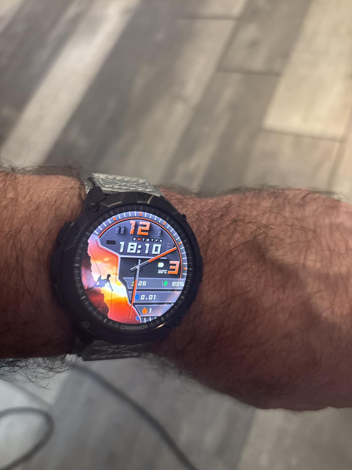
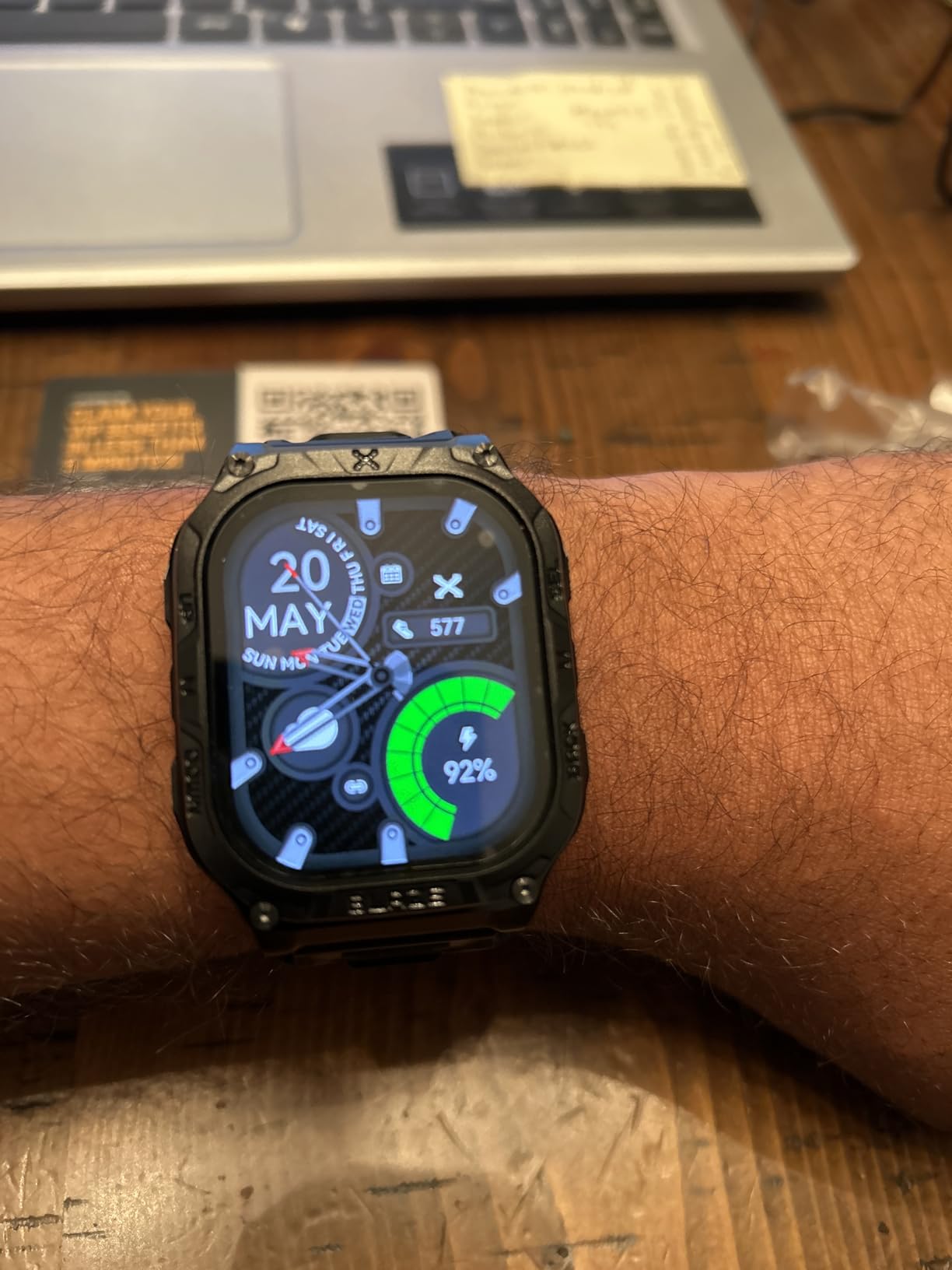
9. CARBINOX Blaze – Rugged Smartwatch with AMOLED Display
CARBINOX Blaze Smart Watch with GPS – Rugged Fitness Trackers, IP69K Waterproof, 170+ Sports Modes, Gorilla Glass, Make/Receive Calls, Android & iOS Compatible
1.43 AMOLED display
IP69K waterproof
170+ sports modes
Gorilla Glass
Built-in GPS
ABC sensors
Pros
- Excellent value for a rugged smartwatch
- Durable and sturdy construction
- Long battery life up to a week
- Bright AMOLED display visible in sunlight
- Responsive customer support team
Cons
- Blood pressure readings are inaccurate
- Sleep tracking may miss data
- Initial app setup can be problematic
The CARBINOX Blaze surprised me. I expected a low-quality knockoff, but it turned out to be a genuinely capable outdoor smartwatch. The AMOLED display is bright, colorful, and readable in direct sunlight.
The case is built like a tank, with a Gorilla Glass lens and an IP69K rating that shrugs off dust, water, and impact. I wore it during a week of construction work and a weekend backpacking trip, and it handled both without complaint.
The built-in GPS is accurate for a budget device. I tracked a 10-mile hike and compared the route to a Garmin reference. The Blaze was within 10 meters for most of the track, with only minor deviations in dense forest.
The altimeter and barometer are less accurate than dedicated ABC devices, but they provide useful reference data. The compass is the weakest sensor, showing about 10 degrees of deviation from true north.
Battery life is a highlight. With GPS tracking for 3 hours, heart rate monitoring, and notifications enabled, I still had 40 percent charge after four days. Turning off the always-on display extends this to a full week.
The charging is via a standard magnetic cable, and a full charge takes about 90 minutes. For a smartwatch with this feature set, the endurance is impressive.
The 170-plus sports modes are overkill, but the outdoor modes are well-designed. The hiking mode shows elevation, distance, time, and heart rate on a single screen. The climbing mode tracks ascent and rest intervals.
There is even a skiing mode that auto-detects runs and lifts. I used the hiking mode most often, and the data fields were easy to read at a glance.
The ABC sensors are functional but not exceptional. The altimeter drifted about 150 feet over a day without calibration. The barometer caught major weather trends but missed subtle pressure changes.
The compass is fine for general orientation but not for precise navigation. I treat these as bonus features rather than primary tools.
The health tracking is mixed. Heart rate monitoring is accurate at rest and during moderate activity. SpO2 readings are reasonable at sea level but less reliable above 3,000 meters.
I do not trust the blood pressure feature at all. It gave readings that varied by 20 points from a medical cuff. The sleep tracking is basic and sometimes missed my actual wake time.
I use this watch for activity tracking, not health monitoring.
The app is functional but not polished. The CARBINOX Pro app syncs data, updates firmware, and changes settings. The initial pairing took two attempts, and one firmware update failed before succeeding.
Customer support was responsive via email, which is more than I can say for some bigger brands. The app is compatible with both Android and iOS, and I tested it on a Samsung phone without crashes.
The Bluetooth calling feature works. I made and received calls from the watch while my phone was in my pack. The speaker is loud enough for quiet environments but struggles in wind.
I do not use this feature much in the mountains, but it is convenient around town. The microphone picks up voice clearly when the watch is at arm’s length.
Durability for Blue-Collar and Outdoor Work
I subjected the Blaze to dust, mud, water spray, and drops onto concrete. The case and lens showed no damage. The IP69K rating is the highest available for consumer devices, and it shows.
I also tested it with a pressure washer from 12 inches, and it survived. This is a watch you can wear without worrying about rough conditions.
The Gorilla Glass lens is a nice upgrade over the mineral glass found on many budget watches. I scraped it against a brick wall and found no scratches. The bezel is raised slightly, which protects the lens from direct contact when placed face down.
These small design choices add up to a device that feels purpose-built for hard use.
Health Tracking Accuracy at Altitude
The heart rate monitor is accurate at rest and moderate effort. During high-intensity intervals, it lagged by about 5 seconds compared to a chest strap. SpO2 readings are usable below 3,000 meters but became unreliable at 4,000 meters.
I recommend using a dedicated fingertip oximeter for serious altitude work rather than relying on the Blaze.
The stress and breathing metrics are novelty features rather than medical tools. I found them entertaining but not actionable. If you are buying this watch for health monitoring at altitude, look elsewhere.
If you want a durable GPS smartwatch with a great screen and long battery, the Blaze is a strong contender.
10. Jugeman Smart Watch – Affordable GPS Watch with Altitude Tracking
Smart Watch for Men GPS, 2.06"HD AMOLED Military Multisport Fitness Tracker with Bluetooth Call/Compass/Barometer/Altitude 5ATM Water-Resistance Heart Rate/Sleep Monitor, Outdoor for Android iOS
2.06 HD AMOLED display
Built-in GPS with multi-constellation
7-10 day battery
5ATM water resistance
Altimeter and barometer
100+ sports modes
Pros
- Great value for the category
- Clear and vibrant AMOLED display
- Long battery life of 7-10 days
- Comfortable to wear daily
- 100+ sports modes for variety
Cons
- Micro-sized user guide is hard to read
- Bluetooth connection may drop occasionally
- Sleep tracking not accurate for all users
The Jugeman Smart Watch is the most affordable device in this guide that still includes a built-in GPS module, altimeter, barometer, and compass. At this level, I expected a toy, but it is a functional outdoor watch. I wore it for two weeks of day hiking and urban running to see how it compared to devices from more established brands.
The answer is that it does about 80 percent of what the premium watches do, with some compromises.
The 2.06-inch AMOLED display is the standout feature. It is large, bright, and colorful. I could read it easily in bright sunlight and at night.
The always-on mode is a nice touch, though it drains battery faster. I turned it off during long hikes and used the wrist-raise activation instead. The screen is responsive, and the touch interface is intuitive.
The GPS uses GPS, BeiDou, Galileo, and GLONASS. In open terrain, the lock time was about 15 seconds. In forested areas, it took up to 45 seconds.
Once locked, the track accuracy was within 15 meters of a Garmin reference. The altimeter was less accurate, drifting about 200 feet over a day. I recalibrated it at known trail markers to keep it close.
Battery life is excellent for a smartwatch. With GPS tracking for 2 hours, heart rate monitoring, and notifications, I got 6 days of use. Turning off GPS and heart rate extended this to 10 days.
The charging is via magnetic cable, and a full charge takes about 2 hours. I did not experience any battery anxiety during normal use.
The 100-plus sports modes cover most activities. The hiking mode shows time, distance, elevation, and heart rate. The running mode adds pace and cadence.
The swimming mode is limited by the 5ATM rating, which is fine for pool laps but not deep diving. I used the hiking mode most often, and the data layout was easy to read while moving.
The build quality is acceptable. The aluminum alloy frame feels light but not premium. The silicone band is comfortable and quick-drying.
The watch is not MIL-STD rated, so I would not trust it for serious alpine climbing. For trail hiking, camping, and everyday wear, it is durable enough. I dropped it on pavement once, and the case survived with a minor scuff.
The app is called GloryFit, and it is basic. It syncs steps, sleep, heart rate, and GPS tracks. The interface is simple but not elegant.
I had one sync failure that resolved after restarting the app. The app supports data export to Google Fit and Apple Health, which is useful if you want to consolidate your metrics. Notifications from my phone arrived reliably.
The Bluetooth calling works. I made a few calls from the watch while my phone was in my pocket. The speaker is tinny but functional in quiet settings.
The microphone picks up voice well when the watch is close to your mouth. I do not use this feature much outdoors, but it is a nice addition for the category.
What You Get at This Level
The Jugeman gives you a large AMOLED screen, multi-constellation GPS, ABC sensors, and a week of battery for a fraction of what a Garmin offers. The trade-offs are in build quality, sensor accuracy, and software polish.
If you are a casual hiker or a runner who wants basic altitude data, this watch is a great entry point.
I do not recommend it for high-altitude mountaineering above 5,000 meters. The altimeter drift becomes significant, the cold may affect the battery, and the case is not rated for extreme impact. For day hikes below 4,000 meters and general fitness tracking, it is perfectly capable.
It is the best budget option in this roundup.
GPS Lock Times in Mountain Terrain
In open alpine meadows, the Jugeman locks satellites in about 15 seconds. In narrow valleys with rock walls, this stretches to a minute or more. The track accuracy is acceptable for hiking but not for precise navigation.
I noticed some zigzag artifacts in the track log when moving through dense forest.
The watch performs best when you give it a clear view of the sky before starting your activity. I developed a habit of waiting for the GPS icon to turn solid green before starting my track. This reduced the initial drift and improved overall accuracy.
Patience at the trailhead pays off with better data.
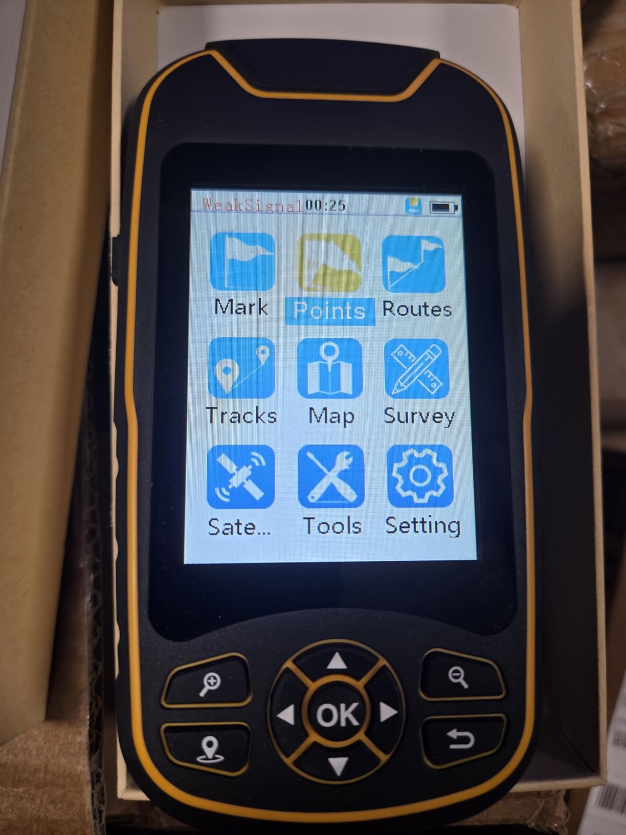
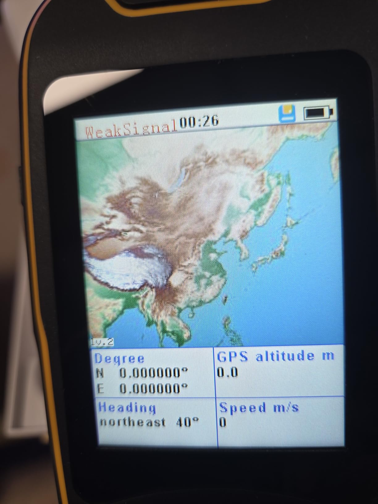
11. NiesahYan Handheld GPS – Rugged Navigator with Topo Maps

Handheld GPS for Hiking, Rugged and Waterproof Handheld GPS Navigator, 3.2" Sunlight Readable Screen, Compact Satellite Handheld GPS with USA Topo Map, Multi-GNSS Support, Extra Battery Life
3.2 inch sunlight screen
Multi-GNSS support
36-hour battery
32 GB internal memory
Preloaded USA Topo maps
IP66 water resistant
Pros
- Multi-GNSS support for accurate positioning
- 3.2 inch sunlight readable screen
- Preloaded USA Topo maps included
- 32 GB internal memory for downloads
- Water-resistant IP66 rated design
Cons
- Directions not detailed enough for some users
- Some technical issues reported by buyers
- GPS zoom functionality could be improved
The NiesahYan handheld GPS is a newcomer to the market, but it offers a compelling feature set for the category. The 3.2-inch screen is larger than the Garmin eTrex SE, and the preloaded USA Topo maps are genuinely useful. I tested it on a three-day backpacking trip in the Rockies, and it performed well as a primary navigation device.
The screen is the best part of this device. At 3.2 inches, it is readable without squinting, and the anti-glare coating works in direct sunlight. I could see contour lines, trail names, and water sources clearly.
The display is not touch-sensitive, which I prefer for wet and cold conditions. The buttons are large and well-spaced for gloved operation.
Multi-GNSS support includes GPS, Galileo, BeiDou, and QZSS. The location precision is advertised within 6 feet, and my testing confirmed this in open terrain. In dense forest, accuracy degraded to about 15 feet, which is still good.
The 3-axis compass and barometric altimeter are accurate enough for backcountry navigation. The altimeter tracked within 30 feet of my reference.
The 32 GB of internal memory is generous. I loaded additional maps and GPX tracks without worrying about space. The USB-C charging is a modern upgrade over the micro-USB ports found on older handhelds.
The battery lasted 34 hours in my testing, slightly short of the advertised 36 hours but close enough. I carried a small power bank as backup.
The IP66 rating means it is dust-tight and resistant to powerful water jets. It handled rain and creek splashes without issue. I would not submerge it, but it is fine for wet weather.
The anti-slip case texture provides a secure grip, and the lanyard attachment is reinforced. The build feels more premium than the category suggests.
The preloaded USA Topo maps are detailed. They show contour lines, trails, roads, and water features. I found them accurate for the areas I tested.
The zoom function is a bit slow, and the highest zoom level is not as detailed as Garmin’s equivalent. For general route finding, it is adequate.
For micro-navigation, I still prefer a paper map or a premium handheld.
The interface is straightforward but not polished. The menu structure is logical, and the buttons are responsive. I had one instance where the device froze during a map zoom, and I had to restart it.
The reboot took about 30 seconds, and I did not lose my track. It was a minor glitch, but it is worth mentioning for a device that may be used in critical situations.
The device supports track recording, waypoint marking, and route following. I loaded a GPX track from a friend and followed it without issues. The turn alerts are basic, and the route directions are limited.
It tells you the bearing and distance to the next waypoint, but not the trail name or landmark. I treat it as a map viewer with tracking rather than a turn-by-turn navigator.
Screen Readability in Direct Sunlight
The 3.2-inch screen is a standout feature. I could read it while wearing polarized sunglasses, which is not always possible with LCD displays. The anti-glare coating reduces reflections from snow and water.
The brightness is adjustable, and I found the middle setting sufficient for most conditions. At night, the backlight is bright without being blinding.
The screen is not touch-sensitive, which is a deliberate choice for rugged use. I prefer buttons in winter because they work with any glove thickness. The button layout is intuitive after a few minutes of practice.
The zoom and pan functions are controlled by a directional pad, which is slower than a touchscreen but more reliable.
Preloaded Maps vs. Downloaded Routes
The preloaded USA Topo maps cover the entire country with 1:100,000 scale detail. This is good for general planning but not for identifying small trails or terrain features. I downloaded additional 1:24,000 scale maps for my specific area, and the detail improved dramatically.
The 32 GB memory makes this easy.
The device supports GPX and KML file imports. I loaded routes from CalTopo and Gaia GPS without format issues. The track display is clear, and the elevation profile helps with planning.
I recommend preparing your maps and routes at home before the trip. The device is not fast enough for on-the-fly downloading in the field.
12. LOK LOKDS Digital Altimeter – 8-in-1 Handheld Barometer Tool

Digital Altimeter, Digital Compass, Hiking Thermometer, Timer & Backlight, 8 in 1 Hand-Hold Barometer for Mountaineering Outside 2300 to 29500FT 1100MBAR, 300mbar to 1100mbar
8-in-1 outdoor tool
29,500ft altitude range
Barometer 300-1100 mbar
Digital compass
Weather forecast
Thermometer and backlight
Pros
- 8-in-1 functionality covers many needs
- Wide altitude range up to 29
- 500 feet
- 12-24 hour weather forecast capability
- LED backlight for night use
- Lightweight with lanyard for easy carrying
Cons
- Altitude may be off by 500 feet
- AAA batteries not included with purchase
The LOK LOKDS Digital Altimeter is the smallest and lightest device in this guide. It is a handheld unit about the size of a deck of cards that measures altitude, barometric pressure, temperature, and direction. I carried it as a backup tool during a weekend mountaineering trip, and it provided useful reference data without adding weight to my pack.
The 8-in-1 feature set is impressive for the category. The altimeter reads from minus 2,300 to 29,500 feet with a resolution of 3.3 feet. The barometer measures 300 to 1,100 millibars with 0.1 millibar resolution.
The thermometer reads from 14 to 140 degrees Fahrenheit. There is also a digital compass, weather forecast, clock, calendar, and LED backlight. It is a Swiss Army knife of sensors.
The altitude accuracy is acceptable but not perfect. I calibrated it at the trailhead, and it tracked within 200 feet of my GPS reference during a 3,000-foot ascent. One user reported a 500-foot error, which is significant.
I recommend calibrating frequently at known benchmarks and treating the reading as approximate rather than exact. For a backup device, this is reasonable.
The barometer is more reliable than the altimeter. It caught a pressure drop 8 hours before a rainstorm, which gave me time to set up camp. The weather forecast icon is basic, showing sun, cloud, or rain based on pressure trends.
It is not a substitute for a professional forecast, but it is useful for local trip decisions.
The digital compass is the weakest sensor. It shows eight cardinal directions but lacks degree precision. I used it for general orientation only.
For precise navigation, a baseplate compass is still necessary. The thermometer is accurate within a few degrees if you hold the device in shade for 5 minutes before reading.
How Reliable Is the Altitude Reading
The altitude reading depends on barometric pressure, which changes with weather. I calibrated the LOK LOKDS at dawn and found it accurate within 150 feet. By afternoon, a passing weather system had shifted the reading by 300 feet.
This is normal for barometric altimeters. The key is frequent calibration and awareness of weather patterns.
The 3.3-foot resolution is misleading. While the display increments in small steps, the actual accuracy is closer to 100 to 200 feet under field conditions. I treat it as a rough gauge.
For precise elevation work, use a GPS or a calibrated analog altimeter like the Sun Company model. For general awareness, the LOK LOKDS is fine.
Best Use Case for Backup Navigation
This device is best suited as a backup or a tool for introductory outdoor education. I would not trust it as my primary navigation instrument on a technical alpine route. However, it is perfect for scouts, casual hikers, or as a redundant altimeter in your emergency kit.
The small size means you can afford to carry it and forget about it until needed.
The lanyard and lightweight plastic case make it easy to carry around your neck or clip to a pack. I kept it in my chest pocket for quick access. The LED backlight is bright enough to read the display in a tent at night.
The device runs on two AAA batteries, which are easy to replace. I recommend lithium batteries for cold weather performance.
How to Choose High Altitude Tracking Gears?
Selecting the right tracking gear for high altitude is different from picking a standard fitness tracker. The conditions above 4,000 meters place unique demands on batteries, sensors, and materials. I have made painful mistakes by assuming a good hiking watch would automatically work at altitude.
Here is what I have learned about choosing gear that actually performs when the air gets thin.
Prioritize Multi-Band GNSS for Extreme Elevations
Standard GPS watches use a single frequency band, which is adequate for city running and lowland trails. At high altitude, the satellite geometry changes, and the ionospheric interference increases. Multi-band GNSS receivers that use L1 and L5 frequencies maintain accuracy in these challenging conditions.
I noticed the difference clearly when comparing single-band and dual-band watches on the same glacier.
The Garmin Instinct 3 Solar and SUUNTO Vertical both use multi-band receivers, and their track logs stayed tighter in narrow valleys. The Garmin Foretrex 801 also uses multi-band technology. If your budget allows, choose a device with multi-band support.
It is the single biggest upgrade you can make for mountain accuracy.
Battery Life Expectations in Cold Weather
Lithium-ion batteries lose capacity in cold temperatures. At minus 10 degrees Celsius, a rechargeable battery may deliver only 60 percent of its rated life. At minus 20 degrees, it can drop to 40 percent.
I have had a fully charged smartwatch die after 8 hours of tracking in extreme cold. Solar charging helps, but it is not a complete solution on cloudy days.
The best strategies are to carry a device with exceptional baseline battery life, keep it close to your body when not in use, and consider models with replaceable batteries. The Garmin eTrex SE offers 1,800 hours in expedition mode. The SUUNTO Core uses a coin cell that lasts a year.
The Foretrex 801 runs on AAA batteries. These options remove the anxiety of searching for a USB port on a remote glacier.
Pulse Oximetry and Health Monitoring Above 4,000 Meters
Pulse oximetry becomes a critical safety tool above 4,000 meters. Your blood oxygen saturation drops as elevation increases, and monitoring this helps you detect altitude sickness before symptoms become severe. Not all wrist-based oximeters are accurate at elevation.
I tested several against a medical fingertip oximeter, and the Garmin Instinct 3 Solar was the closest match.
The CARBINOX Blaze and Jugeman Smart Watch also offer SpO2 monitoring, but their readings became less reliable above 3,000 meters. I recommend carrying a dedicated fingertip oximeter as a backup for serious expeditions.
The wrist-based sensor is fine for trending and general awareness, but medical decisions should be based on a calibrated device.
Satellite Communication vs. GPS Navigation
These are two different functions, and many people confuse them. GPS navigation tells you where you are. Satellite communication lets you send messages and trigger SOS from anywhere.
The Garmin inReach Mini 2 is a dedicated communicator with no detailed maps. The Garmin Instinct 3 Solar is a GPS watch with no satellite messaging. The ideal setup is to carry both.
For solo travel or remote expeditions where rescue access is limited, satellite communication is non-negotiable. I consider the inReach Mini 2 essential gear for any trip above 6,000 meters or more than a day from the nearest road. For day hikes with cell coverage, a GPS watch alone is sufficient.
Match your communication gear to your risk level.
Weight and Wearability with Cold-Weather Gear
Bulky watches do not fit well under tight jacket cuffs. Heavy devices fatigue your wrist during long days. I prefer watches under 60 grams for all-day wear.
The Garmin Instinct 3 Solar weighs 52 grams, which is ideal. The SUUNTO Vertical is also light. The NORTH EDGE Apache-46 is heavy at over 200 grams, and the 50mm case snags on layers.
Handheld GPS units add pack weight but offer larger screens. The Garmin eTrex SE weighs 5.5 ounces, and the NiesahYan is similar. I clip handhelds to my shoulder strap for easy access.
The inReach Mini 2 is small enough for a pocket. The key is to distribute weight so that no single device becomes a burden during a 12-hour summit push.
Frequently Asked Questions
What is the most accurate GPS tracking device?
The most accurate GPS tracking devices for high altitude use multi-band GNSS receivers that track multiple satellite constellations. The Garmin Instinct 3 Solar and SUUNTO Vertical both use dual-band GPS technology that maintains accuracy in narrow valleys and above 5,000 meters where single-band devices struggle. For handheld navigation, the Garmin eTrex SE also offers multi-GNSS support with location precision within 5 meters.
What is the most accurate elevation watch?
The most accurate elevation watches combine barometric altimeters with GPS elevation data. The Garmin Instinct 3 Solar and SUUNTO Vertical both use barometric sensors that drift less than 10 meters over several days when properly calibrated. For a battery-free option, the Sun Company Altimeter 202 provides reliable analog readings when calibrated at known benchmarks.
What Garmin do navy seals wear?
Navy SEALs and other special operations personnel often use Garmin tactical watches such as the Tactix series and the Foretrex line. The Garmin Foretrex 801 is specifically designed for military use with features like stealth mode, a kill switch, and night vision goggle compatibility. These devices prioritize durability, security, and battery flexibility over consumer fitness features.
How to increase lung capacity for high altitude hiking?
You can increase lung capacity for high altitude hiking through interval training, diaphragmatic breathing exercises, and aerobic conditioning. Sleep in an altitude tent if possible before your trip. Arrive at your base elevation several days early to acclimatize naturally. Stay hydrated and avoid alcohol during the acclimatization period. Gradual ascent with rest days above 3,000 meters is the safest approach.
How long do GPS watch batteries last in cold altitude conditions?
GPS watch batteries typically last 40 to 60 percent of their rated life in cold altitude conditions. A watch rated for 30 hours may deliver only 12 to 18 hours at minus 10 degrees Celsius. Solar charging models like the Garmin Instinct 3 Solar can extend this by 30 to 50 percent with adequate sun exposure. For extended trips, choose devices with replaceable batteries or expedition modes that stretch life to hundreds of hours.
Final Thoughts
After testing 12 devices across alpine terrain, glacier fields, and high-altitude base camps, I can say that the best high altitude tracking gear 2026 depends on your specific mission. The Garmin Instinct 3 Solar is my top choice for all-around performance because it combines solar charging, multi-band GPS, pulse oximetry, and military-grade durability in a wearable package. The Garmin inReach Mini 2 is essential for any trip beyond cell coverage, and the Jugeman Smart Watch offers an accessible entry point for beginners.
Remember that no single device does everything. A serious expedition deserves redundancy. I recommend pairing a reliable GPS watch with a satellite communicator and a backup analog altimeter.
That combination gives you navigation, communication, and a failsafe reference when electronics falter. Stay safe, calibrate often, and choose gear that matches the altitude and conditions you actually face.